
Closing the Greenway Gap: A Ride Through Pawtucket’s Riverfront
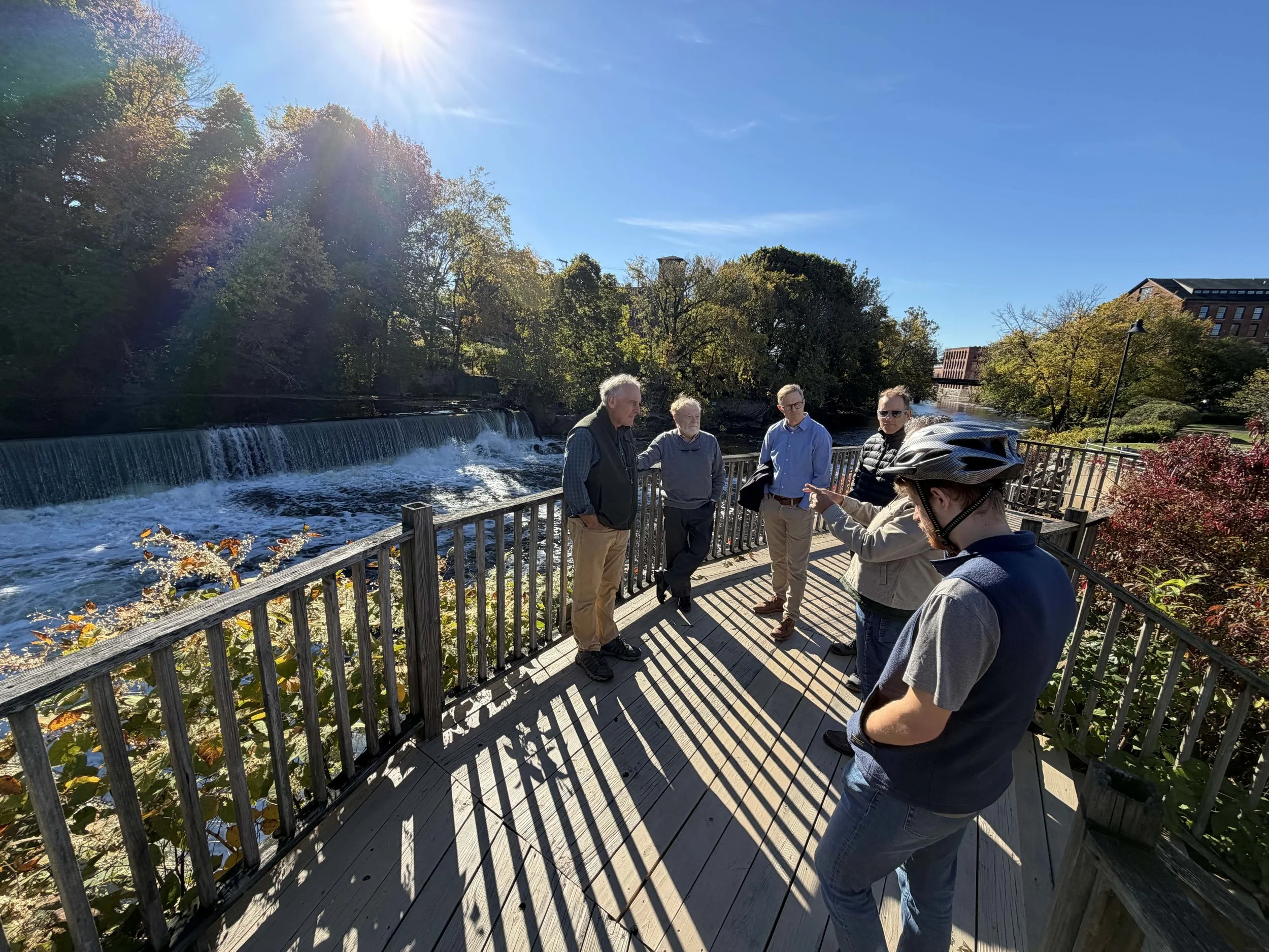
The group surveys Elizabeth Webbing Dam in Central Falls, RI.
Blackstone River Greenway Survey Ride, Part 2 | October 15, 2026
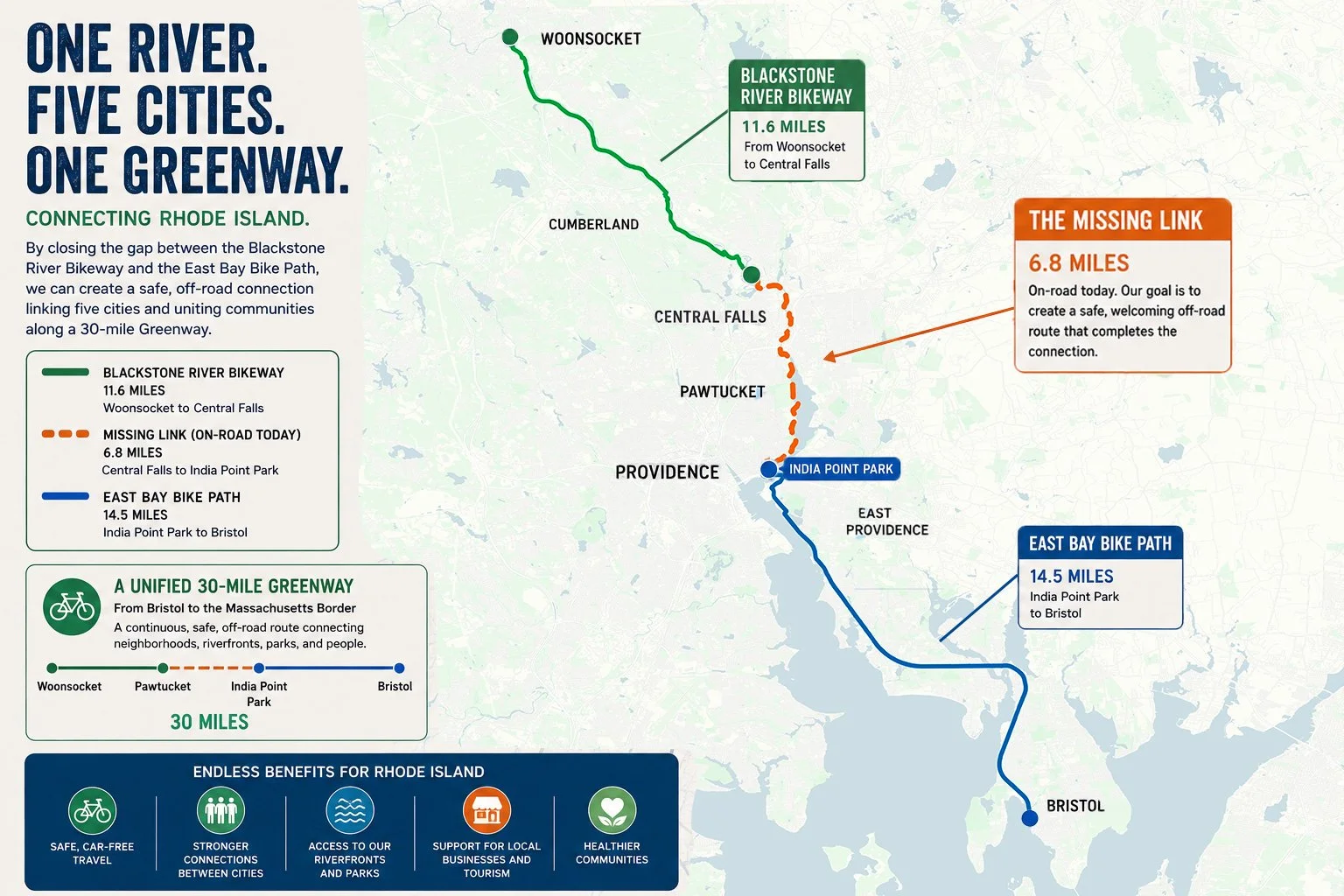
What would it take to connect the Blackstone Valley Bikeway to the East Bay Bike Path with a safe, continuous Greenway?
On October 15, a group of planners, advocates and community members headed into Pawtucket for the second in a series of survey rides exploring the roughly seven-mile on-road gap between these two off-road paths. We are bringing together local knowledge, technical expertise, and relationships to work through the missing connections—one crossing, property, and stretch of shoreline at a time.
Pawtucket offers plenty of reasons to be excited: dramatic river views, existing paths waiting to be connected, and new sections under construction. It also presents some difficult questions about engineering, access, ecological considerations, and how we coordinate projects across municipal boundaries.
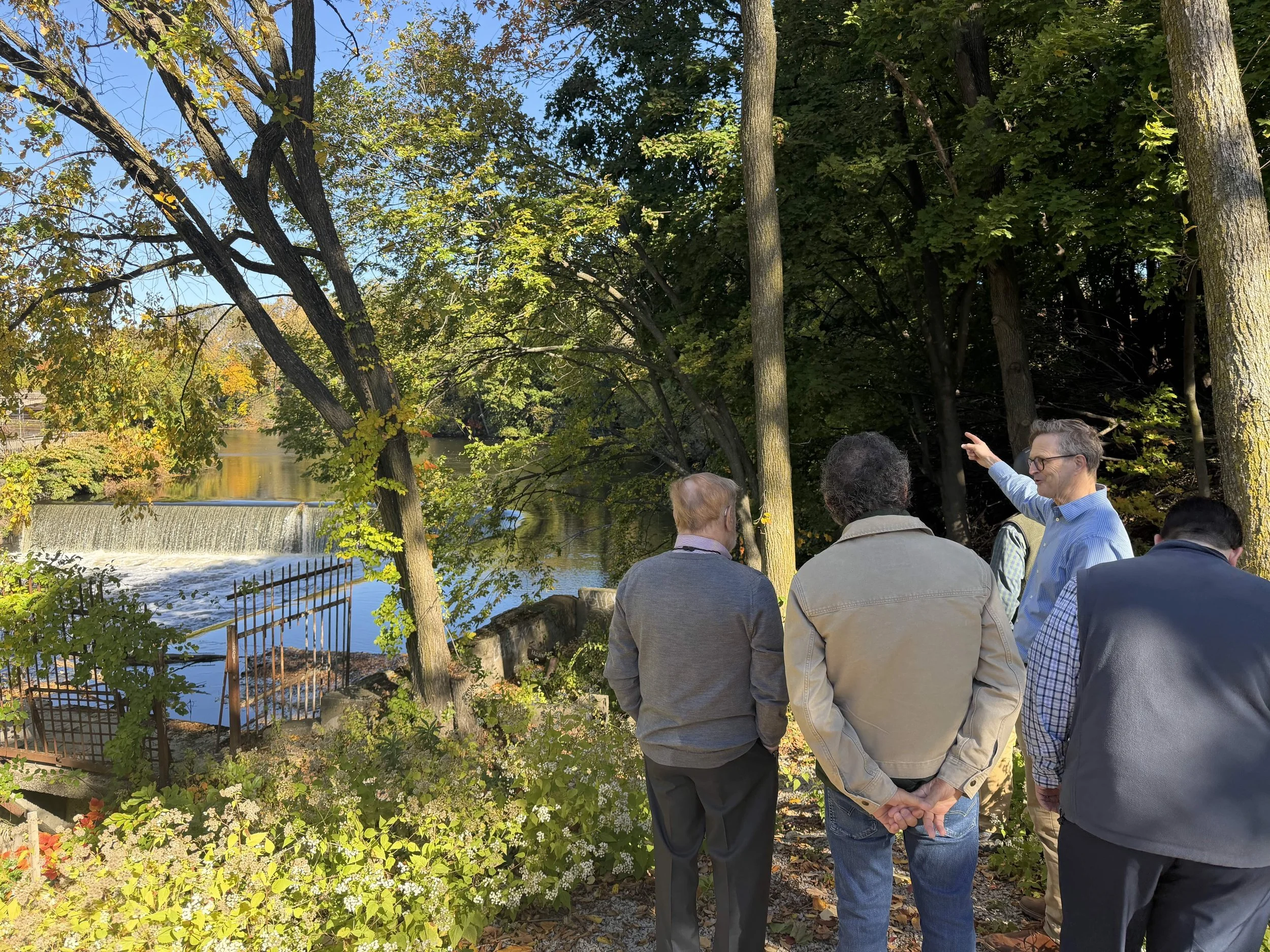
Looking at a lower elevation launch point for the proposed cycle/pedestrian bridge.
Finding a crossing near Elizabeth Webbing Dam
We began near Elizabeth Webbing Dam, where Mike Cassidy described his work on a path running north from Exchange Street along the east side of the Blackstone, including a proposed bicycle and pedestrian bridge near the dam.
The crossing requires a design that accommodates accessible approaches, respects the historic setting, and works alongside existing buildings and property access. One challenge is the elevation of the proposed bridge approach near Blackstone Landing/Collette, beside a fenced transformer station. Its height contributes to the need for a switchback on the opposite bank.
Could moving the approach closer to the dam, where the ground is lower, allow a lower bridge and eliminate that switchback? We explored the possibility on foot. It deserves further engineering review.
We also discussed an alternative route that would remain on the east bank, continue around the bend toward Japonica Street, and cross into Central Falls via the Roosevelt Bridge. Earlier plans explored this alignment, though the steep riverbank would likely require substantial cantilevered structures. Environmental testing and potential remediation would also need to be addressed.
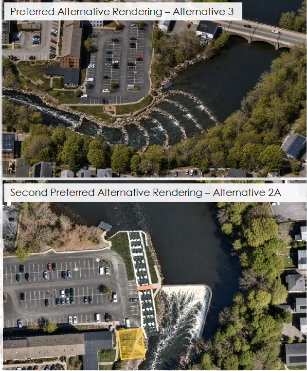
RIDEM’s report on alternative plans for Elizabeth Webbing Dam.
The future of the dam adds another layer. On the day of our ride, RIDEM released its alternatives assessment examining fish passage, dam lowering, and a removal option incorporating weirs and fish passage. Any new bridge should be planned with those possibilities in mind. River restoration and public access need to be considered together.
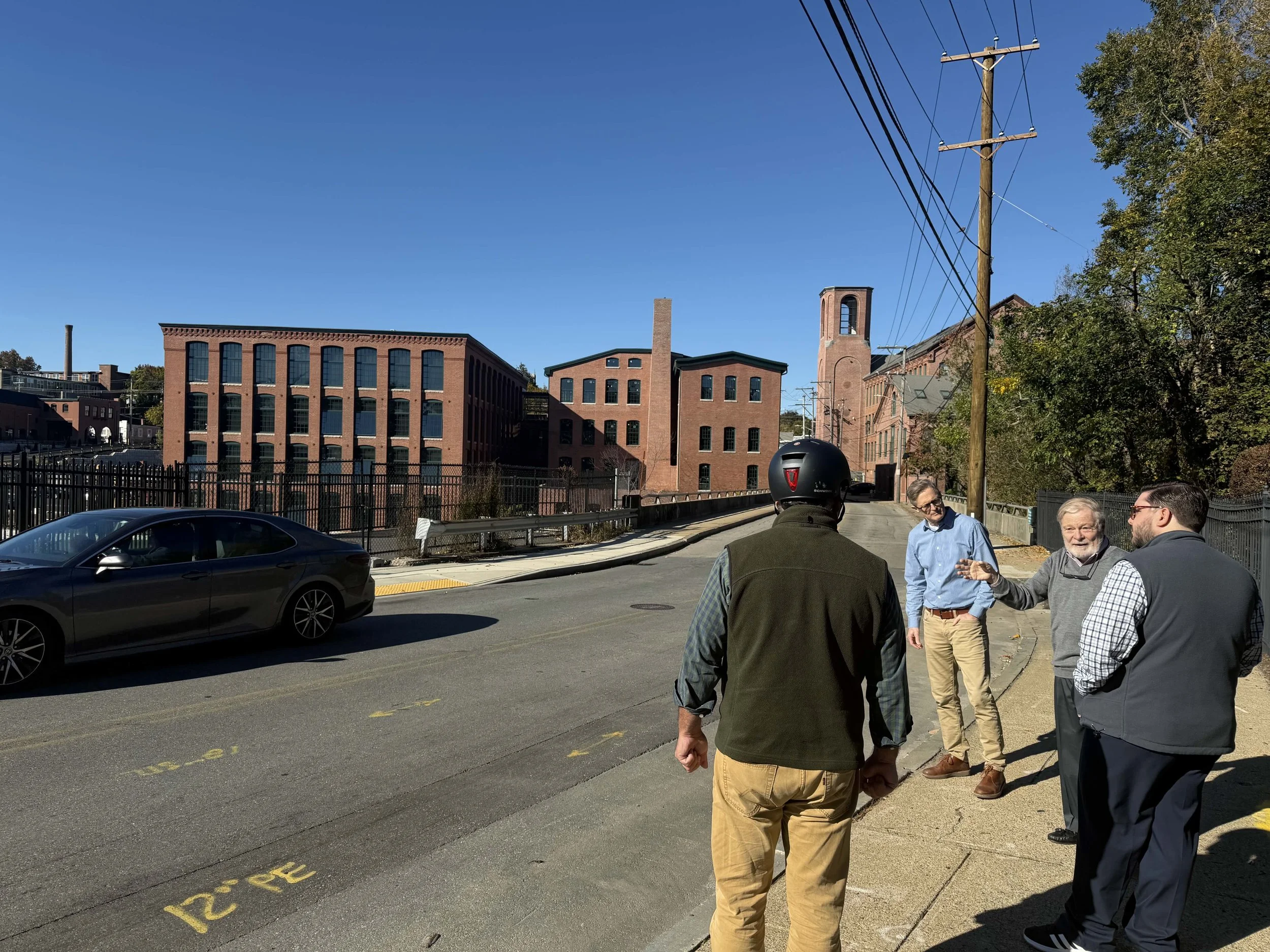
The group surveys the route south of Central Ave Bridge.
Connecting the pieces downtown
Continuing south along Front Street, we looked at the proposed connection toward Exchange Street. Some sections still depend on securing shoreline access and working with existing property owners and businesses.
Farther south, a green strip has been set aside behind the Burbage Theatre for the path. The proposed route would turn toward the river, follow the waterfront parking area at Tolman High School, and cross the Exchange Street bridge to join the existing off-road path just north of City Hall.
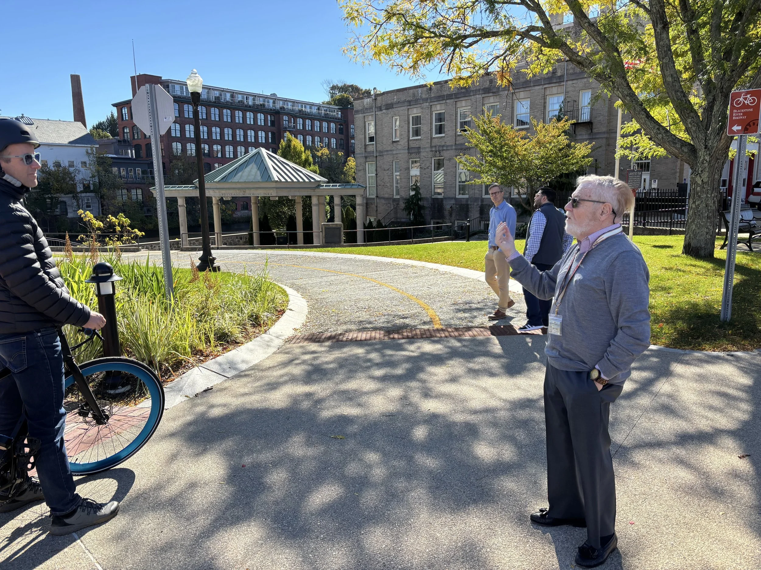
Just north of City Hall, intersection of Exchange/Roosevelt, at the beginning of a short off-road portion.
That path carries riders to Main Street. Beyond it, the Narragansett Bay Commission’s stormwater construction project includes an off-road bike path along the route toward Tidewater Landing, with completion anticipated in mid-to-late 2027.
These are the kinds of connections that make the larger project feel achievable. There are already useful pieces on the ground, with more taking shape.
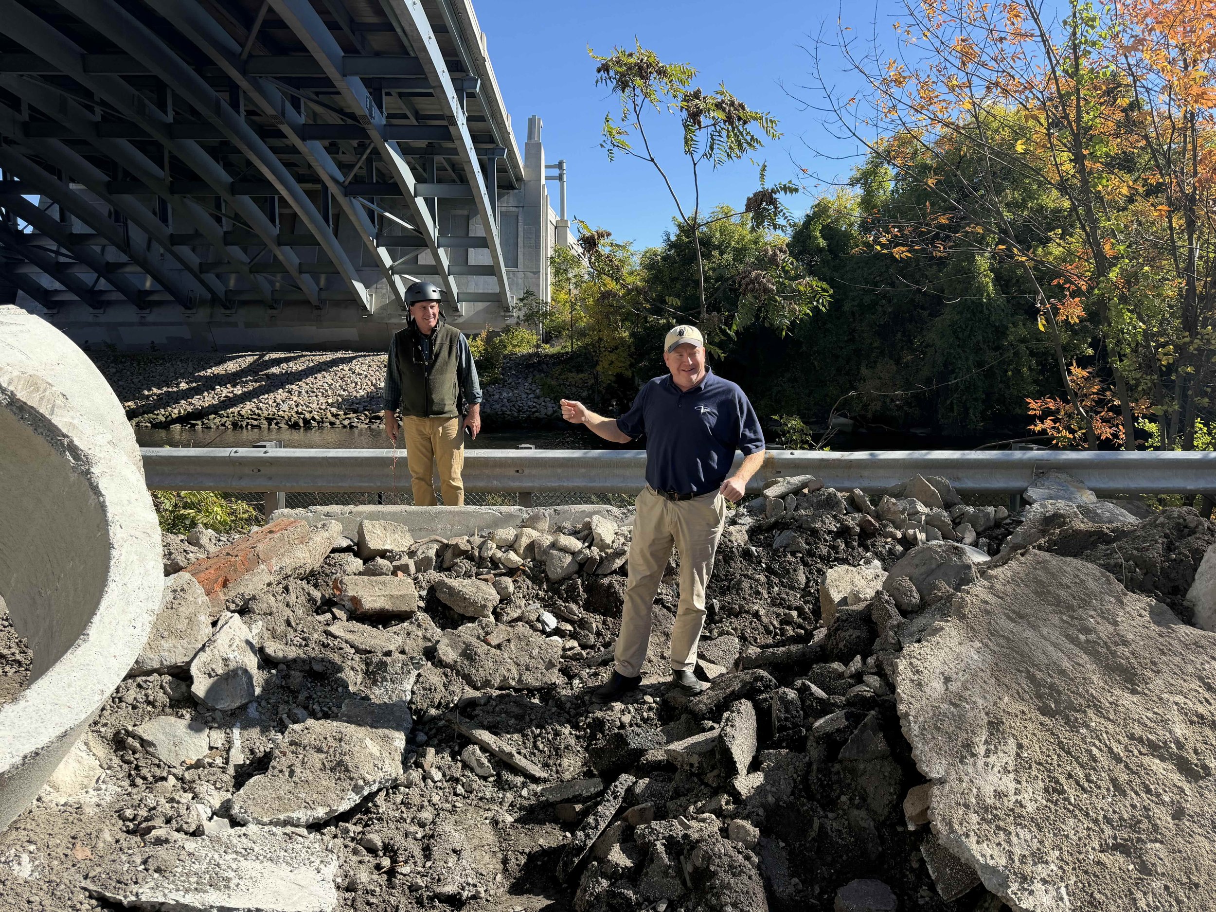
Lance Hill holds court amidst the rubble of Taft St, where a bike trail will soon be.
A higher standard at Tidewater Landing
Lance Hill met us at Town Landing and walked us through the nearby construction projects, including where the new path will follow the shoreline from Taft Street.
Here, the route presents a choice. The official bikeway continues south along Taft Street in front of the stadium, then follows Bowles Court and Pleasant Street past Max Read Fields. Having now ridden it, I am concerned that several narrow, busy sections fall short of the standard we should set for the Greenway.
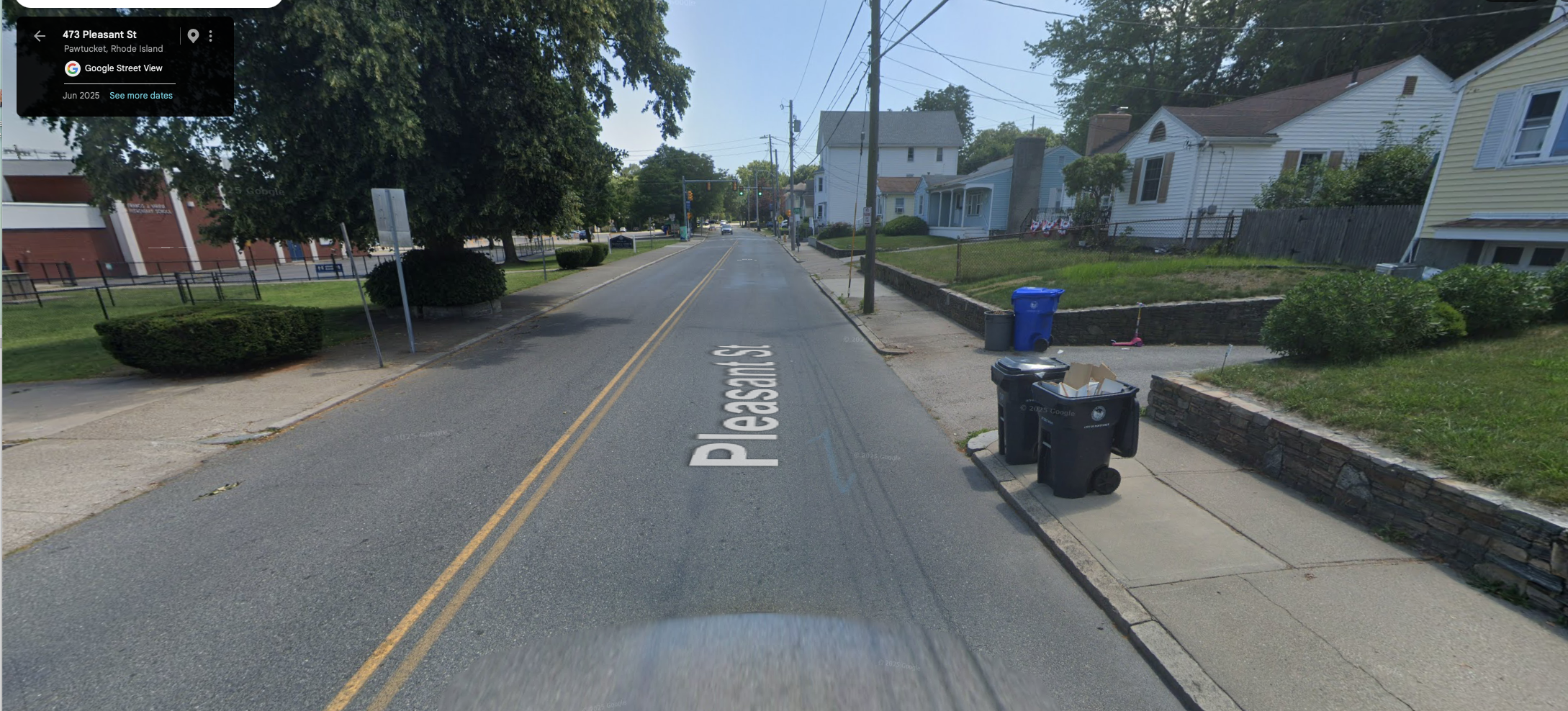
The section of unmarked bike lane on Pleasant Street in front of Varieur School does not feel safe for families to ride.
My test is simple: Would I feel comfortable taking children on this route? For this stretch, the answer is no.
The riverfront alternative is much more promising. It branches off at Town Landing, passes a proposed development and an amphitheater under construction, and follows the completed path in front of the stadium. It is a lovely stretch that makes the possibilities of a continuous waterfront route easy to imagine.
The path continues in front of the neighboring Rhode Island Energy power station, but that section is gated. Establishing public access will require further discussions about access, liability, and upkeep. Additional company-owned land south of the station, behind Varieur Elementary School, would require surveying and permitting. The existing path reaches only as far as the two large transmission towers on the riverbank.
Building a working relationship with Rhode Island Energy could help advance this connection and explore another potential link: a path along the transmission-line easement from Festival Pier to the Ten Mile River path.
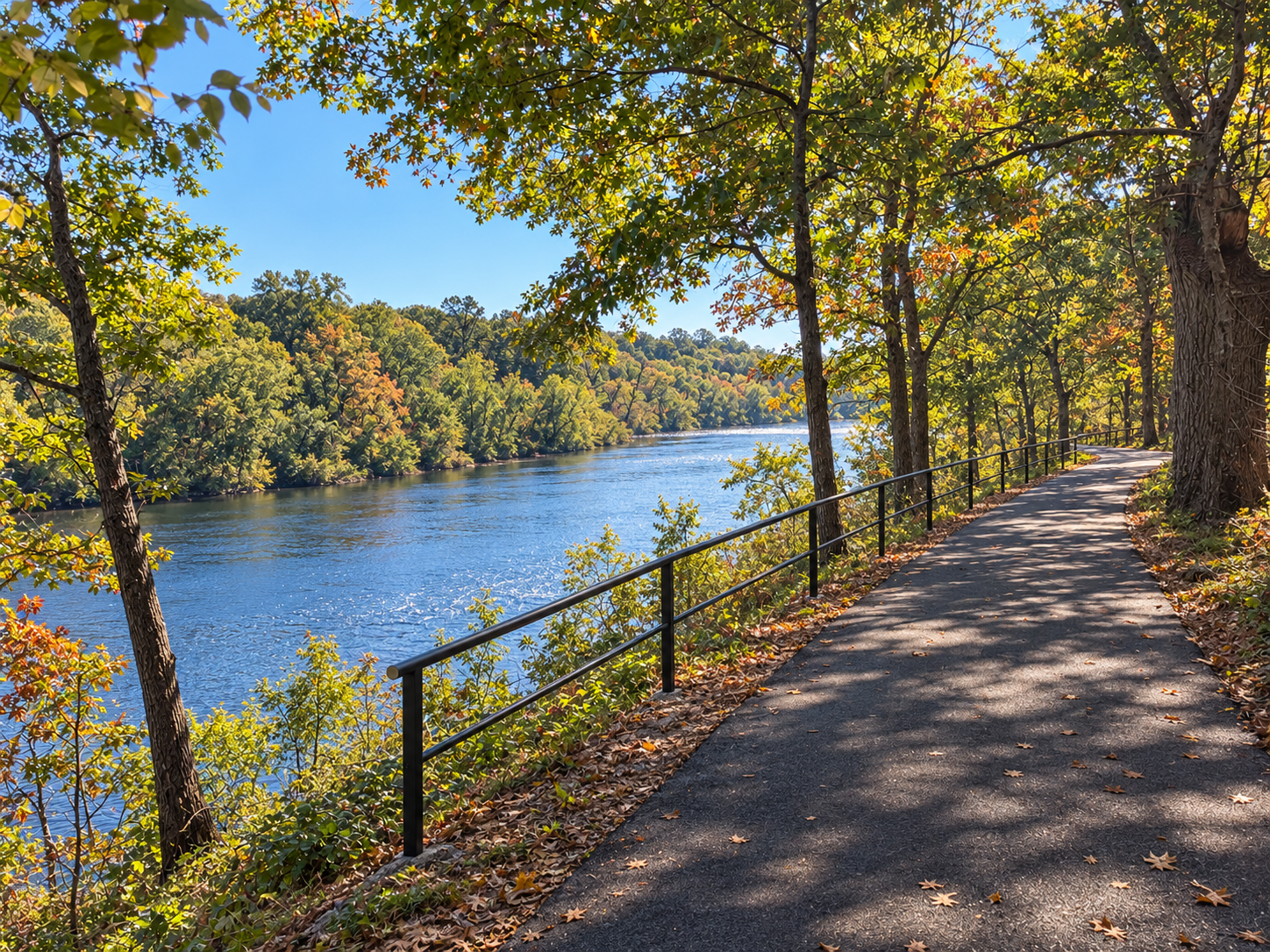
A rendering of the bike path along the bluffs of Riverside, just south of Max Read fields.
Bringing Max Read Fields back to the river
At Max Read Fields, we found a public shoreline access area that was underused and filled with trash. It was a disappointing sight in an otherwise beautiful setting—and a reminder that meaningful public access takes care and investment.
A well-designed path here could transform how people use the park and experience the river.
Just south of the fields, we climbed to land the city recently purchased from Riverside Cemetery. The bluff offers a striking overlook across the Seekonk River. Getting an accessible path up the slope would be an engineering challenge, but the view makes a strong case for working through it.
One possibility is to follow the shoreline before turning uphill toward Pleasant Street. The cemetery-adjacent stretch is considerably quieter than the road farther north, though it may still fall short of the route we ultimately want.
Lance also suggested beginning conversations with Riverside Cemetery and Swan Point Cemetery about whether a continuous shoreline route toward Gulf Avenue might be possible. That would be a longer-term undertaking, beginning with the property owners. The immediate priority is the connection from Max Read Fields to Pleasant Street.
A regional route needs regional coordination
The ride raised questions that extend beyond any single missing link. Who should own and maintain major bikeways? How can we establish consistent standards across municipal boundaries? How do we address environmental barriers that can prevent property owners from participating in public trail projects?
Bob Billington proposed exploring a stronger state role, including managing major bike paths as state parks with consistent oversight and maintenance. He also raised the possibility of legislation addressing remediation liability for landowners who make land available for public trails.
These ideas deserve a broader discussion. Individual municipalities need sustained regional and state support to build and maintain a connected network.
A meeting is scheduled for November 2 with the mayors of Cumberland, Central Falls, Pawtucket, Providence, and East Providence to discuss forming a partnership among the five river communities. Completing the Greenway will be the first project presented for consideration. The hope is that working together can open new opportunities for funding, legislation, and coordinated action.